In this January 2011 post I described a North Pacific seamount discovered in 1950 by the research ship Cobb. In waters thought to be two miles deep, Cobb's sonar detected the tip of an undersea mountain that reached to 110 feet of the surface. Here's a map from a Popular Mechanics showing the location:
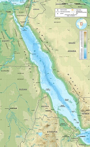
Now we have similar news from the HMS Echo: during explorations of the Red Sea last year, that Royal Navy survey ship found an unmapped seamount rising to 131 feet of the surface, in waters shown on charts as more than 1,200 feet deep. Here's a depth chart of the Red Sea:
Here's a depth-coded sonar image of the newly christened seamount:
Some Red Sea fishermen knew about the Gibraltar-sized pinnacle (since they used the peak as a holding ground for their anchors) but not the mappers.
While no ship draws 131 feet of water (the record holder is Seawise Giant, an ultra-large oil tanker that drew 80 feet of water) the seamount would pose a hazard for submarines.
In the previous post, I described how the nuclear submarine Pogy (SSN-647) ran into an uncharted Pacific seamount in 1972. The sailors survived that high-speed collision, but the boat took major damage.


No comments:
Post a Comment