Comments about technological history, system fractures, and human resilience from James R. Chiles, the author of Inviting Disaster: Lessons from the Edge of Technology (HarperBusiness 2001; paperback 2002) and The God Machine: From Boomerangs to Black Hawks, the Story of the Helicopter (Random House, 2007, paperback 2008)

Thursday, December 11, 2014

HiRISE Over Mars: Next best thing to being there

Even as writers obsess about when Elon Musk will land on Mars, the ever-expanding robot battalion continues to churn out valuable information.

Landers and rovers get much attention, but one of my favorite science packages is the HiRISE imager on board Mars Reconnaissance Orbiter. HiRISE, managed by the U of Arizona's Lunar and Planetary Lab, has been sending back thousands of amazing (and amazingly large), digital photographs of the Martian terrain, for scientists and citizens alike. It's a big beast:


And these are no ordinary snapshots. In full color, each HiRISE image is a strip 4K pixels high by 126K pixels wide. Here's a link to the optical and mechanical stuff. From orbit, the camera can resolve objects a foot across, or even smaller, depending on contrast.

HiRISE shows us that Mars is more diverse and interesting than we might gather from the typical "Mars: reddish god of war" photos. Here's a HiRISE view of Martian dunes:

 
Here's a link to an ebook in HiRISE's "Beautiful Mars" series: Exploring Mojave Crater.

Following is a composite using a HiRISE photo layered on one of my backyard ice images (note: this image is low-res):


HiRise photos are remarkable for the texture they provide, such as waves on sand dunes. I did the blending with Procreate, one of my favorite apps.

More on illustrating with an iPad

From time to time I detour from disasters and techno-history into creative angles. For those who read with their kids, here's a link to a children's book I illustrated on an iPad. It's on Kindle on a free promotion for a few days. Enjoy!

Tuesday, November 25, 2014

Happy 25th, Abyss

This year is the silver anniversary of one of my movie favorites, The Abyss (1989):


Underwater shooting in an abandoned nuclear power plant and a lake in Missouri drove the actors close to desperation

Until 2007, the full-scale set for Deepcore was still intact at the filming location:


Here's a video about building the sets (this is Part 1): 


Fortunately, given all the agony and risk that went into this edgy project, the director's cut has aged well. 

I regard one scene as a remarkably vivid depiction of what a massive system failure feels like for those trapped on the inside. It's a segment in which a massive crane collapses into a moonpool on the Benthic Explorer, and then plummets toward the Deepcore rig, setting off a harrowing chain of events. I've never seen a movie that captured this techno-suspense as well as Abyss. (I'm not a big fan of the last twenty minutes of the film, but the earlier part makes up for it.)

As Shakespeare wrote in Hamlet, sorrows come in battalions rather than single spies, and this part of the movie captures the feeling of utter helplessness as machinery spins out of control.

As I mentioned in this post on the history of underwater exploration, during the 1970s offshore oil companies considered putting manned, underwater drill rigs on the deep ocean bottom, along the line of Deepcore, but in the end they opted for the conventional approach of leaving the wellheads at the mud line, and the drilling rigs on the surface, connected by a riser pipe. 

And it was a smart choice: since then, remotely-operated submersibles have proven to be the best method for carrying out work that's more than a few hundred feet of depth. There's a lot of work for ROVs to do in the deeps of the Gulf of Mexico, off Brazil, off West Africa, and other spots, particularly after production starts. Much of the production hardware -- valve trees, pipes, pumps -- runs along the seafloor, more than two miles down, and only ROVs can handle that kind of maintenance.

Friday, November 14, 2014

MH370: Somewhere out there

Lest we forget, the seafloor search for the missing 777 airliner is underway. Here's the ATSB's weekly update.

A preparatory survey of 150,000 sq km of very rugged seabottom southwest of Australia has been completed. It's considered the most promising. The survey allows sonar towfish to be operated close to the sea floor without running into a cliff. 

Here's a diagram from a presentation about one of the sonar-search ships, Fugro Equator.


Here's one of the sonar-imaging towfish:


More than 96% of that mapped area still awaits a plane-hunting towfish, so it's too early to say whether the towfish are going to find anything based on the sparse satellite signals. 

Having read the Journal of Navigation article by Inmarsat on the analytical methods, I'm confident they're looking in the right place.
The biggest mystery has been the complete lack of MH370 debris in the water or on a beach. Here's the big picture of ocean currents:


I continue to hold to the theory that some massive system failure, such as an oxygen fire that disabled key electronics, was responsible but there's no proof of that ... or anything else. Some useful information might be contained in the 777's maintenance logs, but Malaysia hasn't released those yet. 

Saturday, November 8, 2014

Interstellar Weekend, and another alien landscape

Still churning out Interstellar fan posters on this end, drawing on my vast stock of ice macro-photography:


The difference from my first fan poster is that I've started using Procreate, a graphics app for the iPad. 

After two weeks, I've decided Procreate combines the best features of the five graphics apps I've tried so far: it has a fine set of drawing and painting tools, high resolution (up to 4K images), and excellent options for compositing layers, such as hard light, soft light, and color burn. I give it two thumbs up.

Friday, November 7, 2014

Anniversary, 11-9-79: A very close call

We're coming up on the thirty-fifth anniversary of what could have set off World War III: a close call in the predawn hours of November 9, 1979. It doesn't have a name like its fellow close-call, the Cuban Missile Crisis. Let's call it 11-9-79.

It started at the Cheyenne Mountain Complex, at the time a command bunker for the North American Air Defense Command, NORAD, inside a mountain near Colorado Springs (Photo of North Portal, Wiki Commons):


It led to a high state of alert in SAC terminology -- likely the one called Posture 6 -- because duty officers saw what appeared to be a first-strike, sneak attack: thousands of missiles launched from Soviet submarines and missile bases. 

As standard Cold War history describes it, based on USAF reports and hearings: It happened after some careless person in the NORAD command post inserted a training tape into the wrong computer. The tape contained a scenario showing a missile attack from Soviet forces, and it went onto display screens across air-defense command centers including the Pentagon. The USAF classed it immediately as a likely false alarm and, within a few minutes, duty officers at Cheyenne Mountain confirmed that it was false. All concerns were resolved before the center would have needed to consult the National Command Authorities. No change in DEFCON status resulted, and no aircraft with nuclear weapons were scrambled.

Revisionist history: While the standard account is accurate in broad outline (there was a false missile-attack alert that morning and the USAF realized the fact soon enough) the details are more interesting and scary. I believe 11-9-79 was one of the five most dangerous false alarms of the Cold War like this Soviet one in 1983, which coincided with rather grave misunderstandings about the Able Archer exercises. (Fortunately, a Soviet officer held off elevating that one.)

I looked into 11-9-79 while researching my history of war alerts for Air&Space, "Go to DEFCON 3," but I didn't go into the incident in that article because the event didn't cause a change in DEFCON status. (Why not? It happened so fast there wasn't time for DEFCON alerting.)

Here's a layout of the complex: the labeled Combat Operations Center is what the movie WarGames tried to show, in Hollywood fashion.
 I went into the complex one time, as part of article research on space debris. My view of the command center and its display screens was from a class-walled conference room overlooking the floor, which they called the Battle Cab. (There was a fascinating point I learned there about situational awareness, but that's for another post).

Here's what the Cheyenne command center looked like three years after the 11-9-79 incident (Photo, GWU archives from the US Information Agency):
Certainly not as glitzy as the one portrayed in WarGames, 1983:


Following is what I could gather about how things almost spun out of control inside Cheyenne Mountain -- and outside. See also George Washington University's National Security Archive.
  • In September 1979, two months before the 11-9-79 false alert, the North American Air Defense Command (NORAD) activated a new automated-missile-warning system called 427M at the Cheyenne Mountain command post. Here's a GWU-collected photo of Cheyenne computers in 1982:

  • Numerous investigations had flagged the 427M system as problematic, years behind schedule, and over budget. In 1978 the GAO suggested replacing the entire thing.
  • The 427M system used for missile-attack detection at Cheyenne Mountain relied on two Honeywell 6080 computers to process data from missile-warning sensors, a primary computer and a first backup.
  • In a prolonged effort to sort out the problems with 427M, NORAD was carrying out a test program on a third 6080 computer at Cheyenne. This test program was the source of the attack scenario that got loose on November 9. It was not a “training tape;” it was part of troubleshooting.
  • Although the third 6080 computer used for the test that morning was not intended for operational use, it was connected to the 427M missile-warning system and available on a standby basis, as a secondary backup to the primary backup.
  • Exactly how did it happen? According to NORAD in followup reports, the exact manner could neither be determined or reproduced. I gather that the most likely reason was that the primary 6080 for the 427M system, and then the first backup 6080, crashed. This brought the third 6080 online. Now it was running the test scenario and there was no tag on the screens indicating this was a simulation. So the false information from the third 6080 went into the "Wimex" command and control system and onto Message Generator/Recorder screens at the Strategic Air Command headquarters at Offutt AFB in Nebraska, the National Military Command Center in Washington, and the alternate NMCC.
  • While the Air Force downplayed the response as just routine by-the-book precautions, it went beyond that. At least a dozen warplanes scrambled off runways in Europe and North America. The National Emergency Airborne Command Post (NEACP) took off from Andrews AFB, though without the president or Secretary of Defense (1974 photo via GWU):


    Seven Canadian Air Force CF-101s took to the air. Quick Reaction Alert aircraft (aka Victor alert) flew from NATO bases in Europe and set course for the Soviet border. It's possible that some of the QRA warplanes carried tactical nuclear weapons.
  • Why the big reaction? From what I can gather, the false alert on November 9 was unique in all Cold War history: it was the only time a completely plausible picture of an all-out, sneak attack appeared throughout the key air defense command posts. In all other cases of nuclear-weapon false alerts (going back to 1954), the attack information visible to controllers was strange on its face: glitchy and erratic, or glaringly inconsistent with likely war plans -- that is, displayed as an isolated and small attack.
  • We might not have heard about 11-9-79 except that a reporter from the Washington Star happened to be visiting an air traffic control center at the time and saw the excitement among FAA personnel, who were preparing to contact airliners to tell the crews to land immediately (the famous SCATANA protocol, partially implemented on 9/11).
  • Communications were opened with Washington, in the form of a heads-up call to Carter's national security adviser, Zbigniew Brzezinski. The alert was cancelled before Brzezinski could call the president.
  • While the false alarm was resolved within six minutes, fast enough to avoid an accidental nuclear war, the process didn't go as well as it should have. The duty controllers at Cheyenne were unable to reach a recommendation in the short time permitted them, so the problem went upstairs to senior officers. It was worrisome enough that the USAF directed that the duty officers receive more training on how to handle alerts.
  • One reason that it was so stressful and dangerous is that the false scenario included a submarine-launched ballistic missile attack on the continental US, fired from Soviet submarines not far from US shores. Here's one of their Delta-class subs (photo, USN):

    A little more on the last bullet, the sub-launched missile factor. While our leaders touted their advantage of being resistant to counterattack, they didn't say much about how the close-in fielding of SLBMs (and later, nuclear-tipped cruise missiles, also launched from subs) forced war planners toward a hair-trigger, launch-on-warning stance.
By the 1970s most of us still thought that attacks would come as waves of missiles launched over the Pole from the Soviet heartland, taking 30 to 40 minutes from launch to explosion. Actually the greater risk was from sub-launched ballistic missiles (Photo, USN):


SLBMs would have arrived at coastal targets a few minutes after launch. While SLBMs aren't as numerous as ICBMs, they would have had a truly devastating effect on all command centers, air bases, and major cities within a hundred miles of the coast. There would have been no time for the US to implement the Curtis-LeMay-style war plans of the 1960s, which envisioned scrambling hundreds of bombers and tankers so as to keep them safe from warheads aimed at air bases.

In summary, the world was very lucky that the U.S. didn't happen to be in a crisis with the Soviets at the time, like Able Archer in 1983 or the Yom Kippur War in 1973. (I described in my DEFCON article why the 1973 situation was so dangerous, due to developments in the Mediterranean Sea). 

Otherwise, given such a very realistic picture of sub-launched missiles in flight, and so few minutes to act, I'm sure this alert would have gone to the National Command Authorities ... whether or not President Carter was available.

Thursday, October 23, 2014

What's the X Up To? Stealthy stuff, possibly


The third flight of the X-37B spaceplane is complete ...


 ... but speculation about its classified missions hasn't yet come to earth.  

Given the lack of evidence that the X-37B sidled up to other satellites, the most likely missions have been testing the spacecraft's performance and hauling intelligence-gathering equipment into low orbit.

But what kind of equipment? There it gets interesting. Let's think beyond remote-sensing that's pointed at obvious targets like aircraft carriers, defense factories, seaports, air bases, and mobile-missile testing facilities. Nor is it likely that it's been spying on other satellites (or the Chinese space station) with a telescope, given the enormous closing speeds. 

How about satellite-stealth-related experiments? This is a subject I track given my features on unmanned spacecraft and stealth tactics. I can think of three stealthy subjects the X could assist with. 

Snooping on other countries' stealth aircraft: If the X's payload bay carried the latest technology in infrared (IR) sensing, it might be peering down on flights of China's new stealth aircraft, the J-20, to check for heat signatures. Such an infrared telescope would be mounted inside the X's payload bay, and brought back to earth for upgrading at the end of each trip.

What about stuff moved outside the bay, temporarily or otherwise?

The X could be helping in tests of the latest satellite-stealth measures. Perhaps the USAF is shoving a small, low-observable (“stealthy”) experimental satellite out of the X's bay, and then keeping the X nearby, to facilitate ground-based sensing. That would allow the test satellite to get into low orbit without detection, since there'd be no separate classified launch for nosy people to watch.

Since the X could stay close enough to keep tabs on the testbed satellite's exact location, that would help in analyzing how well distant USAF sensors (on ground or in space) can do in spotting the elusive satellite. 

Background: The USAF considers satellite-stealth something we'll need in case of conflict. But keeping a satellite off a first-tier enemy's monitor screens won't be easy. For example, radar stealthiness (which requires materials to absorb radar energy) tends to raise the spacecraft's surface temperature whenever it's in sunlight. The waste heat makes it more detectable by infrared telescopes. 

To explain: radar stealth argues for a dull, black, absorptive coating on the satellite (as I saw on the B-2A's exterior surfaces when visiting Whiteman AFB for articles) but infrared stealth argues for a mirror-like surface to reflect sunlight, ideally away from the Earth. There is some talk of nano-tech to solve this dilemma. That may be possible, but it would need a lot of testing. 

Another possible stealth approach that the X could help test is simply to reduce the test satellite's radar signature to something that looks like space junk, at least on radar. There's a lot of junk to hide among (image, Wiki Commons):


That's a cheaper form of stealth than nanotechnology. If a tactical satellite could hide among the debris cloud, the USAF wouldn't have to worry as much about infrared emissions, since all the other debris is giving off IR as well. That approach is rather likely in the near term, in my mind. 

Less likely mission, but interesting: the X could be helping to test a prototype gravity gradiometer (GG). This is probably not ready for prime time; maybe in a few years. The GG is said to have the potential to spot enemy satellites that are otherwise completely stealthy in terms of radar, infrared, and visible light. If such enemy satellites weigh a few hundred kilograms or more, a network of GG satellites might detect them dozens of miles away. This would require a networked web of detector satellites, each taking and reporting its own measurements to the X by radio.

Tuesday, October 7, 2014

Experiences vs. Things: A writer's view

Good piece in the Atlantic today, Buy Experiences, Not Things, about what consumers say they get by way of “happiness dividend” when they spend a given amount of money on experiences (a vacation, a concert ticket, a hot-air balloon ride) compared to spending the same money on material stuff. 

According to the studies, purchasers report more happy feelings about the experiences they purchased, than the goods they bought.

One reason may be that while a new gadget like the iPhone 6 inspires people to rush out and join long lines, all such gadgets age, go out of date, and misbehave. While they may be a good spending decision in terms of sheer utility for the dollars, they also may bring as much grief as happiness.  

Yet a bad experience can morph into a positive memory, no matter how maddening the experience was at the moment. Why? It's raw material for a vivid story later, and listeners love a good story.

I can relate to this myself, being a lifelong member of the group that marketers call “Experientials" -- people who love to gather experiences. Advertisers think about experiences that are purchased or that lead to purchases, but I like to think of experience as a part of work.

It's one reason I got into feature writing. Having seen the middle column of the Wall Street Journal's front page as a teenager, I thought that going out to research and write such stories would be a good job to have. It would be an extension of what my parents did for my brothers and me on family trips, going on dozens of factory tours. 

And 36 years of feature writing really did open up lots of interesting places, many of which are normally off limits; and it gave me the chance to visit with many fine people in the places where they work.

So as to encourage newcomers into this line of reportage, here are some highlights from those field trips:

First story, visit into the Pantex nuclear weapons assembly plant in Amarillo, Texas: No, they didn't let me into the warhead-assembly line but it was interesting to go into the plant and learn about thermonuclear weapons and how they are transported hither and yon. Security level: pretty tight.

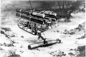
Second story, how buildings would age if abandoned, for Smithsonian: In 1983 I toured the World Trade Center's north tower from basement to roof, and had a long and fascinating conversation with the chief structural engineer, Leslie Robertson. Also I went into the innards of the Grand Coulee Dam and the Gateway Arch in St. Louis. Here's an illustration from that article:

Pennsylvania: Rode with a helicopter crew that maintained live, high-voltage power lines. This very skilled crew worked from an MD-500 helicopter, replacing spacers on a 230,000-volt line.This was the edgiest flying job I've seen first hand: pilot Mark Campolong had to keep the tail rotor within a couple of feet of the cable.

Other helicopter ride-alongs: on a MH60 Black Hawk with a Night Stalkers crew on a training mission out of Fort Campbell, Kentucky, Cobra gunship in Missouri, Sikorsky S-61 flight to to oil rig, Bell 206 in remote stretches of the North Slope.

East Texas: Accompanied a recovery team working out of National Scientific Balloon Facility in Palestine, searching for a one-ton payload that came down in the Piney Woods. That was a lot of fun.

Los Angeles County Fire Department: crawled through their collapsed-building earthquake-training maze and jumped from a helicopter into a lake.

California: went to Jet Propulsion Laboratory in the middle of the night to watch transmissions being prepared for Voyager 2; climbed onto the Deep Space Network antenna in the Mojave to see how the signals go out.

Time in aircraft simulators, with expert instructors: flew a simulated 737 in Delta Airlines' simulator, and a B-2 sim at Whiteman Air Force Base. The latter was a surprisingly high-security shop, perhaps because of war plans that are rehearsed there; even the public affairs officer with me had to prove his identity.

Colorado: Learned how to handle a roaring fire under a large propane tank; then donned bunker gear to crawl from a burning mobile home. 

Texas: a police officer taught me how to make 180-degree turns at 40 mph.

Carthage, Mo: toured a dynamite factory and got a closeup look at metriol trinitrate, a variety of nitroglycerin, flowing from one pipe to another, in the open air, so as to avoid shock waves. Safe to say, this plant had some of the most serious safety precautions I've seen anywhere.

Vertical Assembly Building, Kennedy Space Center: Joined a crew checking the orbiter Columbia for space debris damage; saw solid rocket booster segments being stacked.

Stennis Space Center, MS: Saw a live test of the J-2X engine.

Water Tunnel No. 3, deep under Manhattan and Brooklyn: Visits to the valve chamber and to a tunnel under construction, immediately after blasting. This was the most interesting time, but there's some danger of a rock slab falling on one's head.

Ropesville, Texas: Rode a cable to the top of a radio tower with a construction crew.

NYC: went into the wreckage of World Trade Center 6 (the Customs House), six months after 9/11.

Houston, Texas: Climbed to the top of a tower crane at a construction show.

North Dakota: Visit to the giant phased-array radar antenna that watches for space debris ... and sneak attacks.

Groton, CT: learned how to escape from a sinking, overturned helicopter at Survival Systems Inc. (article is forthcoming in Air&Space).

Kansas and Gulf of Mexico: Spent a total of a week at two oil rigs.

Minnesota: Took lessons on how to fly a helicopter.

Ohio: went into the Ohio State Prison to learn about safecracking from one of the residents.

Los Angeles: Accompanied a raid into a company making counterfeit merchandise, led by a private detective and sheriff's deputies. 

So, thanks to all my expert tour guides!

Friday, October 3, 2014

Interstellar Ice: The Fan-Poster

SF fans counting the days to the premiere of Interstellar are pretty eager to see what Christopher Nolan comes up with.

In my last post I pondered the problem of creating credible but uncanny images of alien neighborhoods, so I scanned my stock of ice photos for something along that line. Here's my shot at a fan-poster for Interstellar:


Except for the NASA image of the spacewalking astronaut on the upper right, all the imagery originates from my wintertime ice field, including the spray of stars. The bubble-headed force-field creature was less than an inch long.

For people who find it hard to believe that macro-photographs can be sufficiently rich in detail and depth of field to stand in for outer space, here's a quote from Douglas Trumbull about the "Stargate" effects near the end of Kubrick's classic, 2001: A Space Odyssey
"The images implied exploding stars, vast galaxies, and immense clouds of interstellar dust and gas. Without revealing too much detail, I'll merely say that these effects involved the interactions of certain chemicals within a camera field of a size no larger than a pack of cigarettes."
I'm working on a PowerPoint SF short story using more ice art, so will be back with a teaser about that.

Imaging the Unimaginable: Alien settings and Interstellar

Interstellar is coming in November! Here's a poster from the official website, and fans are coming up with more.
 

A standing challenge in SF games, graphic novels, and movies is to picture the unimaginable. If someone like Ellie Arroway dropped into an exo-solar civilization, what would she see? How to create visuals that are truly striking and uncanny, but also make enough sense to be processed by the brain? 

Stanley Kubrick's 2001 made an historic stab at it. One of the segments at the end, a fly-through of the Monolith, relies on color-negative aerial photography. Here's a link to Douglas Trumbull's description of the special effects used for the movie. 

Other alienated movies to check out are Solaris, Forbidden Planet, Prometheus, and the original Alien. The latter's spaceship interior (H.R. Giger, designer) still chills and impresses


Monday, June 23, 2014

Costa Concordia: Project Progress


On June 22, Titan-Micoperi reported that all the starboard sponsons for the wreck of Costa Concordia had been attached, including the troublesome S13 flotation tank featured in my previous post. That one needed a do-over. 

That leaves four sponsons to go, all on the port side, which is less damaged than the starboard side. So that's good news for the wreck-refloating and removal later this summer. (Photo, Parbuckling Project)


The next step is an evaluation by the government on Thursday, June 26, about the project's readiness to cope with what is now a very fragile hulk. 

Wednesday, June 11, 2014

JLG Crawler-lift: Ditching ladders and scaffolds for "high inside" work

Finished training last week on how to operate a scissor-lift, and during a break, the instructor showed me a compact, crawler-mounted boomlift marketed by JLG. Here's a photo of it inching through a doorway (twentywheels.com):


I haven't used it, but the idea is cool enough - a track-mounted machine that:
  • Fits through a 40-inch-wide doorway;
  • Can crawl up a 40 percent slope;
  • Expands its footprint via hydraulically actuated outriggers; 
  • Is powered by rechargeable batteries, needing no IC engine or power cord inside;
  • Has a railed platform at the end of an extendable boom that, in the largest model, would let me change a light bulb 75 feet off the floor; and,
  • So I hear, costs a quarter-million dollars.
Photo from JLG of the big one in action:


And, for the well-heeled handyman, it would be very nice for roof work (photo, twentywheels.com)


Thursday, May 29, 2014

MH370 Had a Satellite Phone: New information

I had mentioned in previous MH370 posts that I'd like to know more about what, if any, satellite phones the Boeing 777-200ER airplane carried, and whether there's any evidence of use during the flight. (A satellite phone looks something like a large cellphone, but it relies on satellites rather than cell towers, so a satellite phone is usable worldwide, whether you're calling from mountaintop, ocean, or desert.) 

This obscure subject never got attention from commentators discussing the many mysteries of the flight; rather, the TV air time focused on ACARS messages, speculation about possible cellphone use by passengers if hijacked, and eventually got around to the satellite pings revealed by Inmarsat. 

Of those, Inmarsat's "hand-shake satellite pings" provide the best info we have about the last hours of flight, if sketchy:


Now, we have some glimmerings that go beyond the ping question. Buried in the otherwise tedious 47-page report from Inmarsat listing many hundreds of signals is a page showing satellite-phone log entries. (For those who have had trouble locating the full ping log, here it is.)

Page 40 shows two attempts from the ground to telephone the aircraft, using Inmarsat's satellite-phone service. The first call to MH370 came at 18:39 Coordinated Universal Time, or UTC, or 2:39 am Malaysia Time, and the second came at 23:13 UTC, or 07:13 am Malaysia Time. 

Here's the page:


What's it mean? Maybe not much, but when the mystery is so opaque, just about anything can be interesting. Even the Wikipedia page on MH370 doesn't reference the satellite-phone info.

A few points:
  • Note that the two calls are shown as "not answered," rather than "terminal unreachable." From a lengthy discussion about the ping log on the DuncanSteel website, that suggests the satellite phone had power from the airplane's main circuits; it rang for an extended period; but no one picked up the phone.
  • I feel confident that the calls were directed at a hard-mounted satellite phone intended for priority uses by the crew, rather than a mobile sat-phone carried by a passenger, or one provided for passenger use by the airline. (Note that Malaysia Airlines does advertise that satellite phones are available for business class travelers on this type of airplane, the Boeing 777-200.) 
  • Finally: we are left to guess that the only sat-phone calls made to or from MH370 are the two attempts cited in the log, but we don't know that for sure.
There's solid information from the ping log that the airplane spent another hour in the air following the second call. The airplane then experienced a temporary power failure as the fuel supply ran out. 

All these bits of evidence lead me to think that after a couple of months' pause, the next deep-diving autonomous-submarine searches will center where they should have been all along, the southern terminus of the most likely flight path (graphic by Reuters):


Saturday, May 17, 2014

Costa Concordia Salvage: Trouble at the Big Dents


Since the successful righting of the hulk Costa Concordia by Titan-Micoperi last fall, it's been said often that the most difficult part is over (photo, Parbuckling Project):

That world-famous parbuckling job was accomplished using strand jacks, cables, anchors, temporary steel supports on the seabed, and giant ballast tanks, called sponsons, mounted on the port side.

Though the most spectacular part is complete, I continue to believe that the work to get it off the rocks and into a breaker's yard in one piece will be very difficult and maybe more so than the parbuckling itself.

I'll explain the reasons below, but first this obscure, yet worrisome news item: Last week an 800-ton sponson tank (numbered S13) intended for the starboard side came loose from its fastenings shortly after being placed. Starboard means right side; that's the side facing the shore of Giglio, which was underwater for months until  the ship rolled upright.  

Sponson S13 had positive buoyancy at the time, and in rising out of control, collided with an adjacent sponson. Divers were underwater at the time but apparently no one was injured. 

The heavy-lift Conquest MB1 crane has since loaded Sponson S13 back onto the pontoon barge MAK and now it's back at Genoa for repairs (crane photo, Concordia Group):


As I explained in previous posts, the two sides of the ship present different engineering challenges. Most of the port-side hull was relatively easy to work during the parbuckling preparations, because it was completely exposed to view, and because it wasn't heavily damaged. At the time, the port was the "uppermost side" of the wreck and riggers could work on it while harnessed to safety lines.

Both sides of the ship need to have sponsons installed so the ship will float enough to get it off the rocks and temporary platform; therefore both sides must serve as supports for these giant tanks.

Even now that parbuckling has set the ship upright, the rusty starboard side is much more difficult to work on than the port side had been. For one thing, the starboard side of the hull lies underwater, so work must be done by divers. (The parts in view above the waterline are the superstructure).

Another reason for the current difficulty is that the starboard side sustained enormously more damage than the port side. That side supported the entire deadweight of the ship for months, and much of that stress was concentrated into two zones, fore and aft, where the ship lay on its side, supported mostly by a pair of underwater pinnacles. 

I call those damage zones on the starboard side the Big Dents. Here's a Reuters photo of the starboard side, after parbuckling:


Sponson S13 has to attach onto the dent to the left of the picture, near the aft end of the ship. Here's a Parbuckling Project photo of S13 being lifted into place:


Here's a side view, also from the Project:


The lower diagram in the sponson map below shows the starboard side. Look at the long green rectangle near the stern: 
Sponson S13 is the long green object, horizontally oriented, and it's the one that had the problem earlier this month. From what I gather, the hull at this spot is so dented that a vertical tank can't be secured, so it has to be horizontal instead. 

The official explanation of the recent breakaway of Sponson S13 is that a chain passing under the hull wasn't tight enough, and this slack caused one end of the sponson to lift and damaged another one nearby. There might be more to it; certainly the Big Dent is a very difficult area in which to work.

I hope this post gives a little context to the latest news reports from Titan-Micoperi. To summarize: the ship is severely damaged due to wave motion over the months since the grounding, and because of how the ship came to rest; sponsons need to be placed there anyway to get the ship off the rocks; and the attachment points to that irregular, weakened zone are problematic. The whole ship may be so weakened that it won't hold together under the strain.

So once the hulk lifts off the reef and begins moving (whether under tow, or being pulled onto a semi-submersible recovery ship), it's sure to be a tense time for the salvors.  

Here's my information request of the week: imagery showing the results of an underwater sonar or photogrammetric survey of the starboard side of Costa Concordia.


Tuesday, May 6, 2014

Wish List for the MH370 Report: Did the aircraft have a QAR?

If someone is keeping a Wiki of items that people would like to see covered in the eventual report from Malaysia's accident investigation board, here's one for the list.

Many 777s, but not all, carry a Quick Access Recorder in the E&E Bay. When British Airways Flight 38 crashed on landing in 2008, investigators tapped into a QAR on board. 

A QAR is sort of like a Flight Data Recorder in that it stores flight data, except that, unlike the FDR, it offers easy removal of information. Airlines buy and use this optional gear to improve operational quality over time. 

Here's a photo of a Teledyne Controls QAR:


QAR downloads and analyses are vital to a good quality program. Here's a snippet on QARs from a report by Canada's Transportation Safety Board:

"Initiatives undertaken by airlines, such as the development and implementation of increasingly complex flight operational quality assurance programs, require that an increased number of data sets be recorded. Quick access recorders (QAR) were developed because information in FDRs was not easily accessible for routine maintenance and monitoring of aircraft systems. This type of recording has been done on QARs, which are not required by regulation. Most QARs in use routinely record far more data parameters, at higher resolution and sampling rates, than do FDRs."


If the MH370 aircraft (9M-MRO) had a QAR installed, then downloads from previous flights are in the hands of Malaysia Airlines. Even before the airplane turns up, these downloads could have information of real interest, such as error messages connected to past maintenance work. Further, then the airliner's wreckage is found, a QAR holding data from the last flight might be of enormous value if the tail section (which holds the FDR) broke up and the FDR can't be located. While QARs aren't built to be crash-rated, their contents -- even when only partially recoverable -- have been helpful to investigators of several recent crashes, Swissair 111 being one.

An electronic data-processing device analogous to the QAR, called the accumulator, was of great value in the Costa Concordia investigation, because the Voyage Data Recorder malfunctioned on its last trip. Fortunately, the accumulator served as an emergency backup.

Note: If the airframe didn't have a QAR installed, that would make me question the airline's attention to quality. Just saying!

Tuesday, April 29, 2014

Wake-up Call: San Jose Airport's porous perimeter

 The teenager who climbed a fence at Mineta San Jose International Airport and expressed himself to Hawaii in a 767's wheelwell was the subject of some hilarity on talk radio, but the fact that he got over the perimeter fence and remained unseen for more than five hours was nothing but bad news. Airports everywhere should pay attention.
 
I'd have thought San Jose is above-average in intruder awareness. In 1975, following other assaults nearby, an armed man forced his way into the San Jose airport grounds with several hostages in tow and tried to hijack a 727 -- a desperate, murderous plan that ended when a police sharpshooter killed him with a single round.
 
Here's one reason I worry about future intruders hopping the perimeter fence (photo, Google Maps):
 
 
That's a FedEx cargo airliner in the photo, and it's parked at San Jose International not far from the passenger terminal. Anyone who gets onto the grounds undetected can just as easily climb aboard a cargo jet, and not just the wheel-well, either.
 
Cargo jets remain a major security concern for all of us, and not just because of their mostly-unscrutinized cargo. Their flight crews are very small, even on huge jets - and armed attackers wouldn't have to worry about the passengers organizing to strike back, as happened on Flight 93. As of 2010, long after 9/11, most cargo jets still didn't have hardened cockpit doors.
 
Twenty years ago this month, armed with a hammer, a single assailant (disgruntled FedEx employee Auburn Calloway, aboard as deadheading crewmember) came very close to commandeering and crashing FedEx Flight 705 out of Memphis. That was a DC-10 jumbo which, coincidentally, was scheduled to land at San Jose airport.
 
Both FedEx and UPS planes land at San Jose, and if hijacked, they're plenty big enough to destroy a skyscraper.


Saturday, April 26, 2014

Immersion Course: Escaping from flooded helicopters

This is to provide a little more detail for my LinkedIn post last week, asking for survivors of helicopter ditchings to drop me a line, because I'm researching a magazine article on helicopter-underwater-escape training, or HUET.

The reason for the obscure business known as a HUET school is that an aircraft, once upside down, flooding, and sinking, presents scary challenges that must be managed quickly in order to survive. Advance preparation and the right equipment can add margin to the survivability zone

Across all aircraft types, helicopters are unusually top-heavy and therefore prone to roll over in the water. Here's a video of an Mi-14 crash off Japan; note how quickly it rolled after the main rotor hit the water and flew apart:


Let's say a helicopter has emergency pop-out floats; the floats may keep a ditched helo from sinking immediately, but those people in the cabin are still underwater and they'll soon drown if they don't get out.

Tens of thousands of people travel regularly over water in helicopters and small airplanes, hence the HUET market. Singer Jimmy Buffett attributes his surviving a Widgeon crash to ditched-aircraft training he took in a Navy program.
Courses vary in how much realism they pose, since higher realism means higher risk. To manage situations with elevated risks, schools put multiple safety divers in the water, right next to students.

A course at the lesser end of the realism scale could be classroom talks, a demonstration of survival gear, and a quick dunk in the pool. At the opposite end of the scale, and more for the military and USCG rescue swimmers, a facility's pool might have big waves, wind, several people having to use the same exit door in a dunker rig, and simulated entanglement on the way.

During our course at Survival Systems Inc., we had to get out of a blacked-out cabin that was upside-down and flooded. We worked up to abandoning a blocked exit and finding another door across the cabin.

While instructors assured us that the course was quite safe for students who followed directions, the training can be stressful for those of us who are scared of drowning. I came away from the course with bruised fingers and thumbs, having gripped things somewhat too hard while groping for exit handles. But the instructors were very good at taking us one step at a time, building confidence so that we didn't freak out as the dunker splashed down and water came up our noses.
 
HUET courses aren't about memorizing and then following a one-size-fits-all checklist. We were reminded frequently that to survive a helicopter ditching we'd have to get our bearings before loosening the seat belt, think clearly, and use the methods most appropriate to the situation.
 
For example, just because a survivor of a helicopter ditching has a small compressed-air SCUBA-like tank at her side (often called HEEDs) that doesn't mean she should always activate it, even if the cabin is flooding. Here's a HEED bottle (photo, lifesavingsystems.com):


The time she'd need to get the HEED going -- say five to seven seconds -- might be better spent escaping on a breath-hold if she was sitting by an exit door. Also, that speeds things up for others who may need to use the same door.

The H-60 Black Hawk sinks like a rock once it's full of water, so time is of the essence. Instructors showed us a video of a CH-46 Sea Knight tumbling backward off the deck of an aircraft carrier: it vanished in a sheet of spray, going under in less than two seconds.
 
Though no single checklist of actions will cover all circumstances, here are three things to keep in mind:
  • Before takeoff, give close study to the exits nearest you. Some crashes come without warning to the passengers, so don't assume there'll be time to study up;
  • After a crash, don't give way to panic;
  • Don't ever give up.
So, repeating my request on LinkedIn: if you've escaped a flooded aircraft after a crash, feel free to drop me a line.

Thursday, April 10, 2014

The Ladder in the Road: A question for Google cars

The other afternoon during rush hour I was unpleasantly surprised to see a heavy extension ladder lying across my lane (the middle of three lanes), in heavy traffic moving at 55 to 60 mph. The first I learned about it was when a truck ahead of me swerved into an empty lane -- so there it was, leaving me a little less than two seconds to assess the situation and decide what to do.
 
 It's a good example of real-world decision making, where there may be no good choices, only less-bad ones.

What's a Google  self-driving car programmed to do in such a situation? While researching the topic of autonomous vehicles for my article on spacecraft and other self-driving systems, and in followup reading, I didn't see an answer to this in various articles about Google cars. (Diagram from The Economist):


I'm not as good as a Google car's ever-spinning LIDAR turret at monitoring all the cars around me, but I do keep my mirrors swung out so I can stay aware of where the cars are. The unpleasant choices I had, in my Google-less car:
  • Swerve into the left lane: No, there's a car in the way.
  • Swerve into the right lane: No, a car there too.
  • Hit the brakes and come to a tire-smoking stop on the freeway: Given the lack of warning, that posed a significant risk of being rear-ended. I'd do that for a pedestrian in the road, but not a ladder.
  • Drive right over the ladder: I could do that, but at the risk of tearing out something in the front end, flipping the ladder into the air, and losing control myself.
  • If I slowed to half speed I could let the car on my left pass, so I could get behind it, but there wouldn't be enough time to get myself fully in the left lane. But that would reduce the impact, since I could drive over just one end of the ladder. I could see that one end was mostly flattened already, by a previous impact.
The last option looked like the best so I did that, and barely managed to get through the problem without hitting anybody, ripping out my car's oil pan, or losing control. But it was a close-run thing.

So this question to the Google engineers: in the dozen or so Google cars now on the road each day, what's your algorithm for handling dangerous obstacles in the road, that are not visible to the LIDAR because of trucks ahead? 

And don't say "we'll just hand it back to the guy in the driver's seat, who'll have a half-minute to take over." That's okay for some problems like bad weather on the horizon, or road construction ahead, where twenty seconds is enough for an inattentive driver to come up to awareness, but not for a dangerous object just a few car-lengths ahead.

I come across a short-span crisis like this every year or two, and each needs an immediate decision that doesn't end in a crash. Novice drivers may not realize how very easy it is to lose control at highway speeds; it can happen just by tapping another car's bumper and then over-controlling, or by swerving too energetically for the speed.

And the results can be instantly disastrous: One minute you're zipping along at the speed limit, safe and sound; but lose control and suddenly, your car is rolling over and over and throwing things out the windows, including any passengers not belted in.

I understand that in the coming years, car-to-car communication might reduce the sudden-obstacle problem because cars will communicate about such things via a rolling WiFi -- that'll be a big help -- but in the meantime, what's the plan?

Saturday, April 5, 2014

The Inhuman History of ROVs: Part 2

Continuing from Part 1, based on my history of ROVs for Invention & Technology:

= = = = =

Setting aside military trials (such as the US Navy, which lowered an undersea TV camera to check on A-bomb blast damage to shipwrecks near Bikini Atoll, and the British Navy, which used another to look for a sunken submarine), credit for the first civilian ROV probably goes to Dimitri Rebikoff of France. Frustrated by the fact that some Mediterranean wrecks were too deep for divers to investigate, he installed a camera in a pressure-resistant housing, added a water-corrected lens, and mounted it on a tether-controlled vehicle that he dubbed Poodle.
 
 
For extra treasure-finding skills, he added a magnetometer and sonar set. (ROV experts credit Poodle as the world's ROV, albeit an unarmed one. Having recently built a diver-driven, one-man underwater scooter called Pegasus for use by the Submarine Alpine Club of Cannes, France, Rebikoff had a head start in building Poodle's controls and power train.) On its first use in 1954, Poodle sent up video of two previously unexplored Phoenician wrecks, one 700 feet down.

U.S. Navy labs and Navy contractors built other camera-carrying ROVs, one of which was Snoopy, notable for its reliance on direct hydraulic drive, transferred from tender to vehicle through a long tether-hose (today's ROVs all rely on electrical power, as did the successor, Electric Snoopy).

The first ROV to hit the water with manipulator arms emerged from a US Navy laboratory in Pasadena, California: Cable-Controlled Underwater Recovery Vehicle, or CURV.
 
 
Originally tasked with bringing back torpedoes that failed to rise to the surface after test shots, CURV-I made international news in 1966 off Palomares, Spain, where an H-bomb had plummeted into the Mediterranean Sea after a bomber collision. The bomb was resting precariously on the lip of a steep slope in a skein of parachute shrouds, which for a few terrifying moments had tangled with the manned submersible Alvin when that craft had tried to attach lifting shackles. Though at 2,850 feet the bomb lay well below CURV's rated depth, CURV reached the spot without imploding and finished the rigging job. Seven years later, successor CURV III helped rescue the two-man crew of a submersible stuck on the sea floor off the Irish coast.

The Navy's Remote Unmanned Work System, fielded after CURV, was directed at search and recovery work.
 
 
Challenges overcome in its development pointed the way to today's work-class ROVs. “The Idea was to go to 20,000 feet with all the tools you needed to recover a black box,” said Wernli. This would give access to the great majority of objects on the ocean floor, since abyssal trenches are rare. The great depth could have posed a serious problem in cable handling: If connected directly to a boat on the surface via a single, thick cable more than four miles long, the ROV would have been at the mercy of any deep currents pulling at the line.
 
The solution was to use two cables: a strong umbilical line reinforced with Kevlar fiber that plummets straight down from the tender to a base station (called the Primary Cable Termination), hanging above the sea floor; and a lightweight and neutrally buoyant tether that's paid out horizontally as the ROV ventures off to work nearby.
 
 
This arrangement has been very successful, because it keeps cables from dragging along the sea floors, where the slightest turbulence will stir up a cloud of talcum-fine silt that blocks visibility for hours.
 
Work class ROVs use the same arrangement today, and it's what I saw when shadowing an Oceaneering crew on a drillship in the Gulf of Mexico. Today, the umbilical terminates at a strong metal cage that serves as a garage for the ROV when not in use.

The North Sea turned the tide in favor of ROVs. With exploratory wells having proven large reserves of oil and gas by 1970, and with oil prices high after the first oil embargo, production began in 1975. The conditions – undersea wellheads far from shore, and frequent storms – were so novel that by 1980, development and installation costs outran American expenses for the Apollo moonshots. Reserves estimated at 70 billion barrels kept them going.

The early years saw dozens of manned submersibles and hundreds of divers at work, with ROVs at the margin, little more than a curiosity, of doubtful reliability. Typical was the “flying eyeball” model, which kept its camera trained on a diver to monitor his safety. But by 1980, as abilities expanded and reliability improved, ROV fleets surged.
 
Although the North Sea fields are shallower than waters off West Africa, Brazil, and the Gulf of Mexico, it was a proving ground for critical advances: connectors that didn't short out in seawater, acoustic beacons for precise navigation around a sunken structure, robust manipulators, and high-quality video. Some of the most important developments at this time had less to do with ROV hardware and more to do with wellhead hardware.

“That was the big turning point,” said Wernli. “When [oilfield engineers] accepted they had to go deep, they started designing the equipment for that: how the subsea equipment would be operated, how valves would be turned. The key is that whenever would be needing an ROV there had to be standard docking so it could plug something in or manipulate something. In other words, they got the tooling in place.” As an example, if a valve needs turning, it's better to provide handles designed specifically for powerful, rotating claws than to expect the ROV to wield a crescent wrench.
 
On the Deepwater Horizon emergency-response spillcam sites, viewers could see ROV claws wielding shears, circular saws, and diamond wire cutters. ROVs can also carry drills, abrasive wheels, and jets to cut steel with high pressure water and abrasive powder. Such tools will be handy for deepwater decommissioning work, that costly day at the end of a well's useful life when oil companies are obligated by federal regulations to cut away old pipes, valves, and other sea-bottom steelwork for hoisting to the surface. The idea is that nothing will be left above the mudline, except those structures approved to serve as artificial reefs.
Decades from now such work might be turned over to AUVs, or autonomous underwater vehicles. AUVs are now restricted to going off on relatively simple missions, and must find their way back or surface to open up a temporary link via satellite. An AUV's job might include seawater sampling, surveys of the ocean floor preparatory to pipelaying, or minehunting for the Navy.
 
If given the ability to recharge along the way, AUVs can work for many weeks before returning. Oil companies have great expectations that, with time, AUVs can be promoted from surveys to detailed inspection of underwater equipment such as checking valves for proper function, and then move on to routine maintenance jobs. This will allow the more elaborate ROVs to focus on the complicated jobs, such as “workovers” of aging wells, and replacement of corroded parts and leaking packers.

While deepwater technology is often compared to space shots, the most intriguing development, to me, is how experience from the oilfields suggests that humans can't compete with robots when doing high-stakes work in dangerous conditions, when figured on a business basis. Yes, today's underwater "robots" are really remote-control actuators, depending on humans to control the details of each job at a safe distance, via levers and knobs.
 
But artificial intelligence is advancing on a fast track, and with each passing year robots will be given more authority to exercise judgment, based on how they interpret instrument readings and video images.
 
From what I hear, some of the most advanced autonomous underwater vehicles (AUVs) today are devoted to minehunting. Their job is to seek out sleeper mines on the seafloor, an anti-ship tactic quite likely to be used in the next major conflict.